Sunday, October 21, 2012

Lab 3

NOTE: ZOOM OUT TO SEE ALL LOCATIONS!!!


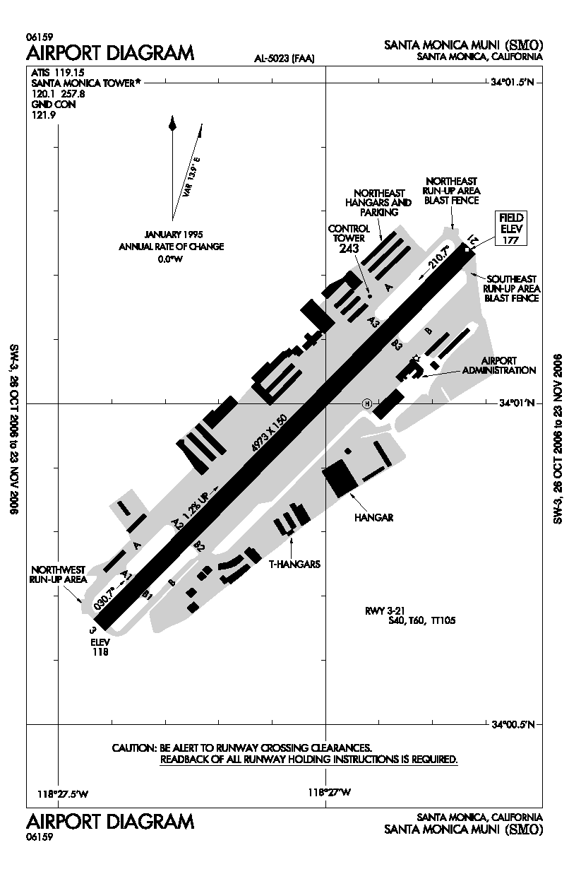
View Aviation Nation in a larger map

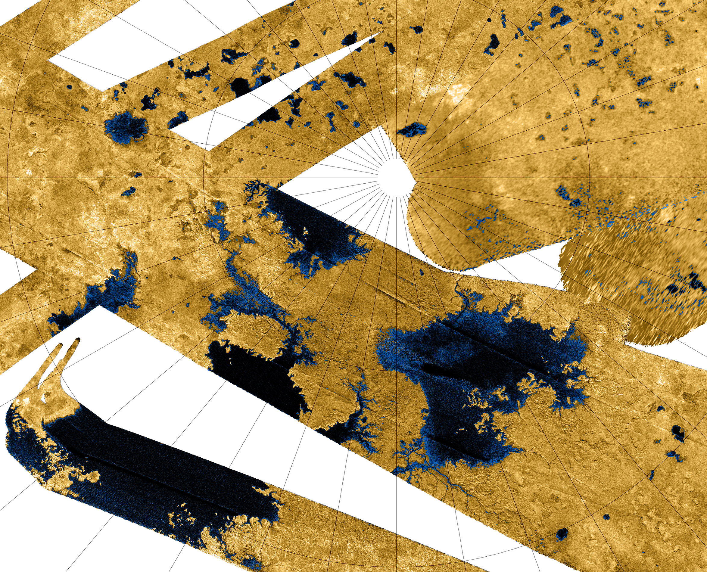
         There is no doubt that neogeography has changed the way in which people live and interact with each other. As just a small component of an ever-advancing technological world, neogeography has many positive implications and uses, and has the potential to (and does) vastly improve our lives. Perhaps the most noticeable advantage to the average person is neogeography's revolution of navigation. Navigation has been made more precise, more accurate, faster, and more easily accessible with the existence and prevalence of geography systems in cell phones, computers, GPS devices in cars, and many other devices. With the aid of technology, it is almost difficult for one to be lost in this modern era of navigation. Additionally, law enforcement and EMS can utilize GPS tracking systems in cell phones and other devices to find a criminal's last known location, locate an individual in need of help, or perform a variety of other tasks that are helpful to society. Furthermore, the existence of the internet has given the average person a stronger voice in the process of online and interactive mapmaking, as a sort of "democratization" of mapping has emerged in the past few years. There are instances in which people can vote for the names of new bridges, roads, and other structures or places that will soon be featured on new maps. This sort of interaction leads to an increased geographic awareness of the average person, and serves to highlight and promote the importance of GIS and neogeography alike. As more and more individuals become geographically aware, we can more easily improve upon existing geographic systems and technologies that serve to help us all.
          Of course there are downsides and pitfalls to a rapidly evolving society in which neogeography is so prevalent. Privacy is one of the main concerns, as neogeography can sometimes be invasive in nature, in that an individual's location may be broadcasted against his or her will on a social networking website. In addition to this, criminals, or other individuals with nefarious intentions can easily take advantage of knowing the location of a person of interest, which is often broadcasted in real time. It is not uncommon for companies such as Apple to track customer's locations and browsing histories to use for advertising purposes, and there is currently a heated debate as to whether or not certain government tracking practices are unconstitutional. In addition to the individual suffering from a lack of privacy, modern governments should expect the world to know of radar facilities, or other installations with sensitive locations, should they be in plain view on the surface of the earth. Aside from privacy concerns, the exponential increase in technological innovation has caused a similar rise in the expectations of these technologies and how they perform. It's easy and common to become angry in response to a navigation system giving slightly less than perfect directions. Finally, the cost of technology relating to neogeography is something to consider, as technological innovation is rarely cheap, and has vast financial implications on companies or agencies working to contribute to a rapidly evolving world.

Monday, October 15, 2012

Lab 2

1. Beverly Hills Quadrangle
2. Canoga Park, Van Nuys, Burbank, Topanga, Hollywood, Venice, Inglewood
3. 1995
4. The North American Datum of 1927 (NAD 27)
5. 1: 24,000
6. a) 5cm x 24000 = 120000/100 = 1,200 meters
    b) 5in. x 24000 = 120000/63360 = 1.894 miles
    c) 1mile x 5280ft x 12in. = 63360/24000 = 2.64 inches
    d) 3km x 1000m x 100cm = 300000/24000 = 12.5 cm
7. 20 feet
8. a) 34°04'23" , 118°26'23"   34.073 , 118.440
    b) 34°00'25" , 118°30'00"   34.007 , 118.500
    c) 34°07'05" , 118°24'35"   34.118 , 118.410
9. a) 560 feet   170.7 meters
    b) 140 feet   42.7 meters
    c) 740 feet   225.5 meters
10. Zone 11S
11. Zone 11 36200m E , 3776000m N
12. 1,000,000 square meters

13.
 
14. 14°48'
15. From north to south

16.

Wednesday, October 3, 2012

The source of this map is from the wikipedia [www.wikipedia.org] article on Titan, the moon of the planet Saturn. Here is the url link: [http://upload.wikimedia.org/wikipedia/commons/e/e8/PIA10008_Seas_and_Lakes_on_Titan.jpg]. Although I found the picture on wikipedia.org, the original source of this picture is the NASA website at the following url: [http://photojournal.jpl.nasa.gov/catalog/?IDNumber=PIA10008]. This map is a false-color mosaic of the north pole of Titan, which is a moon orbiting the planet Saturn. It covers approximately 60 percent of the entire north polar region. The darker features that account for approximately 14 percent of this map are believed to be liquid hydrocarbon lakes on the surface of the moon, most likely containing liquid methane, ethane, and dissolved nitrogen. Solid surface is indicated by the light golden-brown color. This image was taken with the radar instruments on the Cassini-Huygens probe currently orbiting Saturn. The large dark feature located in the lower left portion of the image is 40,000 square miles in area, which is larger than Earth's Lake Superior. I find absolutely everything about this map to be interesting, but what stands out most is the presence of liquid bodies on Titan. Titan is the only body in the solar system, moon or planet, besides Earth, that is known to possess large bodies of liquid on its surface. The intricate geography and detailed surface features of the solid land are also quite intriguing and alien, literally. Titan is mysteriously shrouded in a thick atmosphere and has been a topic of study for astronomers for centuries and scientists have just recently made these astonishing discoveries.


The source of this map is the wikipedia [www.wikipedia.org] article on Santa Monica Airport. The following is the link tothe image: [http://upload.wikimedia.org/wikipedia/commons/8/8a/SMO_-_FAA_airport_diagram.gif]. The original source of this image can be found on the FAA website [faa.gov] at [http://www.naco.faa.gov/index.asp?xml=naco/online/d_tpp]. This is the official FAA diagram of Santa Monica Airport, which is located in the south-eastern corner of the city of Santa Monica. This map shows the number of runways (only one), the dimensions of this runway, and its slope. In addition to this, the map reveals more accurate measurements of the runway heading, and the magnetic directions associated with it. Furthermore, the map labels and identifies the hangers and buildings found around Santa Monica Airport. The map is displayed on top of latitude and longitude lines down to the minute. Finally, the map labels taxiways and heliports. I find this map interesting because of my love of aviation and aeronautics. I think it's fascinating that a map so simple can convey so much information to pilots and air traffic controllers alike to safely and effectively operate aircraft at this airport. I also think that the amount of intricate detail in this map is quite interesting.


The source of this map is a website called type of words [typeofwords.com] at this url: [http://typeofwords.com/wp-content/uploads/2010/01/philadelphia_1842.jpg]. This map, which dates back a few dozen decades, shows the checkerboard-like layout of downtown Philadelphia, also known today as Center City. This map shows the bodies of water that border downtown Philly, the Schuykill and Delaware rivers, as well as many of the street names. A legend is given for the various abbreviations found on the map, and the harbors on the eastern side of the city are also labeled. A scale (in feet) is also given at the bottom of the map. Furthermore, the various parks scattered throughout the city known as "squares" are also labeled. This map is interesting to me because the majority of my family resides in Philadelphia, and I have spent a great deal of time there. I am familiar with its layout, and it is interesting to see it in this perspective. Additionally, the old age of this map only adds to my already exiting interest, as I have a fascination with all things ancient and archaic.